Rock River Refuge is a 200+ acre property donated to Captina Conservancy in 2015, portions of which are newly opened to the public for hiking.
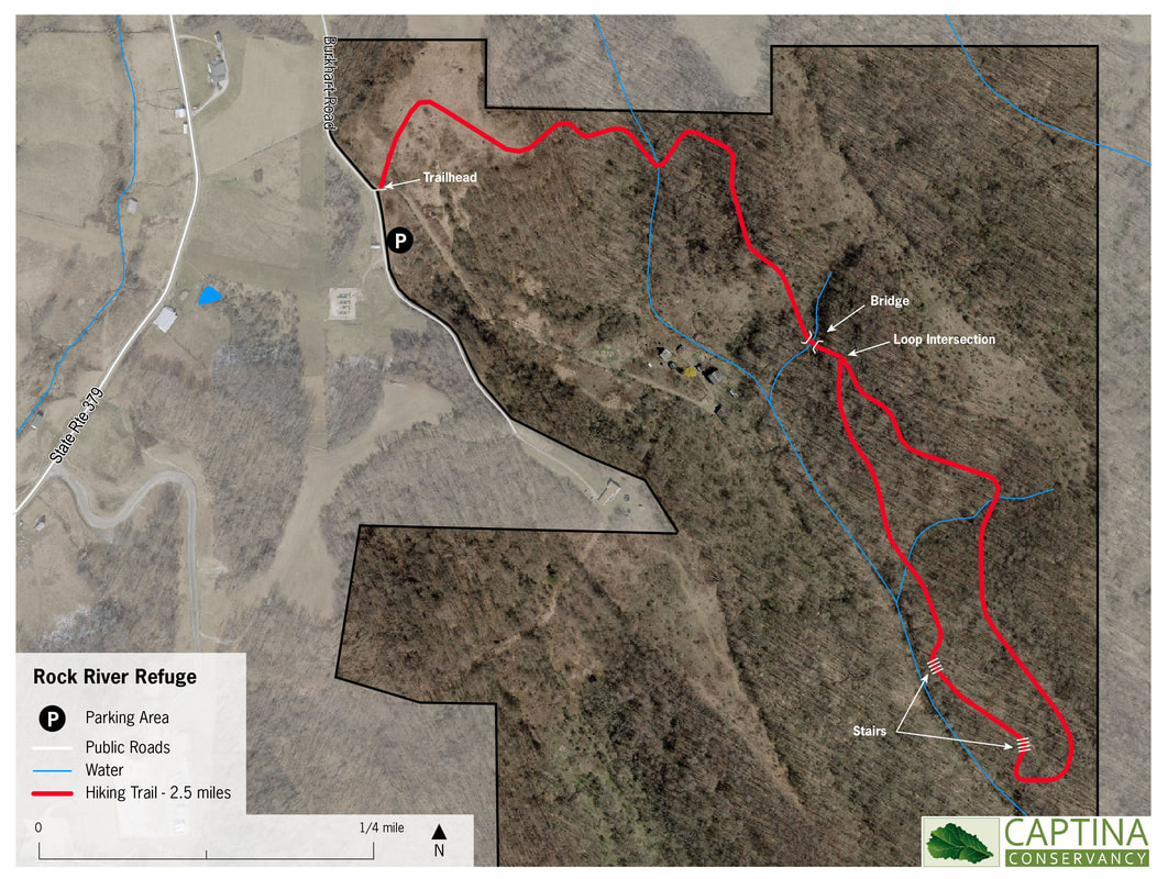
Located in southwest Belmont County, the property contains a 2.5 mile hiking trail of intermediate to difficult hiking over sometimes rocky and uneven terrain. The trail features views of unique sandstone cliffs and rock formations, ravines, streams, and mature old growth forest. Captina Conservancy designated this property as a refuge because we hope for it to be a place of peace, comfort and enjoyment for people, plants, and animals alike. Please help us achieve that goal by respecting the life that you find there.
Located in southwest Belmont County, the property contains a 2.5 mile hiking trail of intermediate to difficult hiking over sometimes rocky and uneven terrain. The trail features views of unique sandstone cliffs and rock formations, ravines, streams, and mature old growth forest. Captina Conservancy designated this property as a refuge because we hope for it to be a place of peace, comfort and enjoyment for people, plants, and animals alike. Please help us achieve that goal by respecting the life that you find there.
trail rules
Help us protect and preserve your refuge!
- Open sunrise to sunset
- Stay on trail, respect natural areas, do not alter or remove plants or wildlife
- All refuse carried in must be carried out
- Dogs must be under control, and owners must pick up after dogs
- No climbing on cliffs, boulders or rocks
- No motorized vehicles or horses
- No camping or open fires
- No firearms or hunting
Report Trail Conditions
Has a tree fallen across the trail? Are the blazes not visible? We appreciate your help monitoring trail conditions. Please email [email protected] to report any dangerous trail conditions.
LOCATION
GPS Location: 39.891065, -81.226609
Note: The trailhead is located off of McLaughlin Road, which is sometimes called Burkhart Road on GPS directions. McLaughlin/Burkhart Road intersects with State Route 379 about two miles south of Temperanceville, Ohio.
Note: The trailhead is located off of McLaughlin Road, which is sometimes called Burkhart Road on GPS directions. McLaughlin/Burkhart Road intersects with State Route 379 about two miles south of Temperanceville, Ohio.
About the land
Rock River Refuge is a diverse tract of land. In some areas, fallow farm fields are slowly recovering with a prevalence of broom sedge and goldenrod. In other fields, pioneer species such as tulip tree, black locust, dogwood and black cherry are establishing. The forested sections of the property are populated with oak and hickory along the ridge tops and tulip tree and sugar maple on the lower portions of the slopes. The understory is very clear in the interior of the forest with a number of large chestnut oak and white oak. The forested sections also feature scenic sandstone outcroppings. A number of small streams, tributaries to Rock River, cross the property and are in healthy condition, with unimpacted streambanks and forested riparian corridors.
This diversity of habitat allows for a diversity of wildlife. Foxes, coyotes, and bobcats hunt the edges between forest and field, where rodents and other small mammals thrive. White tailed deer and turkeys congregate in fields and forests. A variety of bird species feast on shrub bushes and nest in tall trees. Clear streams, and rock outcroppings provide shelter and water needed for many varieties of wildlife.
This diversity of habitat allows for a diversity of wildlife. Foxes, coyotes, and bobcats hunt the edges between forest and field, where rodents and other small mammals thrive. White tailed deer and turkeys congregate in fields and forests. A variety of bird species feast on shrub bushes and nest in tall trees. Clear streams, and rock outcroppings provide shelter and water needed for many varieties of wildlife.
HISTORY
Nestled in the southwest corner of Belmont County, this 200+ acre property has seen a rich history over the years. Little is currently known about the first humans to live on this land, and the cultures that were present before European colonists arrived. However, by the mid-1600s, the area was occupied by Native American tribes forced west into Ohio from their traditional lands by colonists. Between the mid-1600s to the late 1700s, the Lenape (or Delaware), Shawnee, and Wyandot tribes lived and hunted in the area. It also likely served as hunting ground for Iroquois tribes. In the late 1700s, the British and U.S. governments forcibly removed these tribes and distributed the land to American colonists. For the next two hundred years, settlers used the land for subsistence and agriculture.
Starting in the early 1800s, the property was a self-sustaining farm, home to the McLaughlin family for many generations. The family grew field crops, dairy cows, pigs, vegetables and an orchard. Wayne Mason purchased the property in the 1990s, with a goal to create a home for wildlife. He thus left the property mostly untouched until he donated it to the Conservancy in 2015.
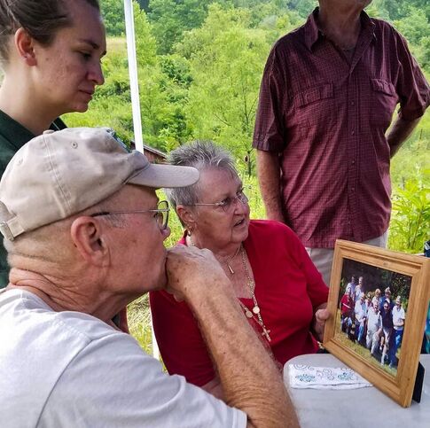
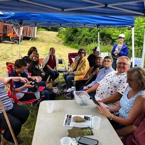
In 2018, Captina Conservancy hosted a picnic with members of the McLaughlin family who had grown up there. It was a good time of story telling, photo sharing, and appreciation of the family’s history on the property.
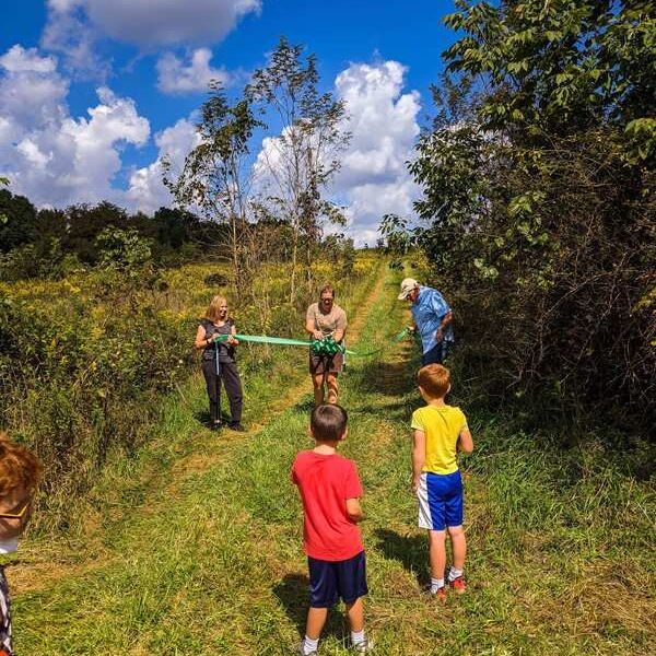
In 2020, the Conservancy launched a plan to create a hiking trail to allow public access to a portion of the property, and share the natural beauty of stone rock faces, ravines and gorges, and mature hardwood forest. The property has been christened Rock River Refuge, to denote the tributary to Rock River (also sometimes called Rock Creek) that flows through the land and “Refuge” to indicate it as a place of peace, safety, and restoration for both people and wildlife.


