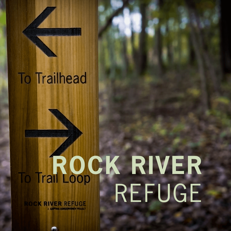
Captina Conservancy strives to provide multiple educational and recreational projects that are open to the public.
Each project meets our mission to "promote, preserve and protect the biodiversity, the natural beauty, and the environmental health of the Captina Creek and regional watersheds."
Each project meets our mission to "promote, preserve and protect the biodiversity, the natural beauty, and the environmental health of the Captina Creek and regional watersheds."
FEATURED PROJECTS
Visit our newest public hiking trail, meet the oldest known living hellbender, or attend one of our upcoming events at Captina Conservancy.
|

|

DYSART
WOODS |
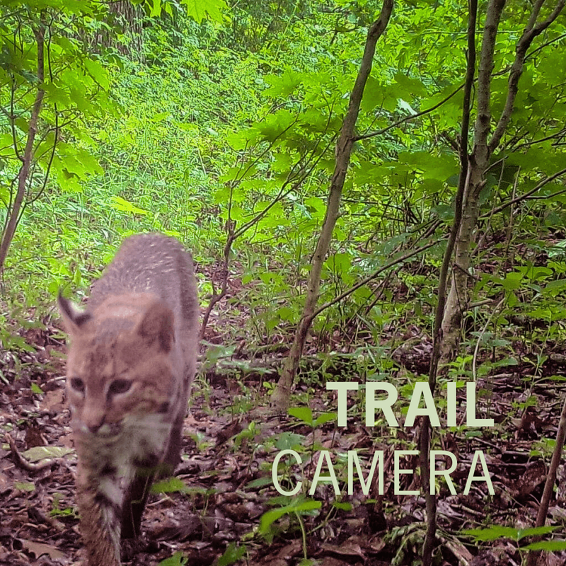
Explore Watershed Wildlife
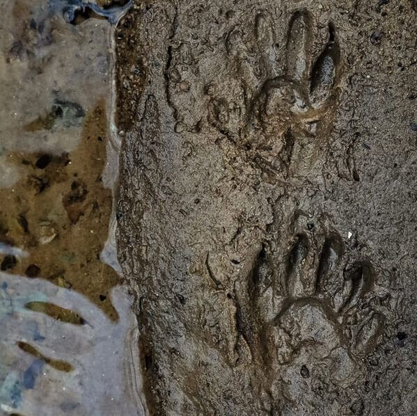
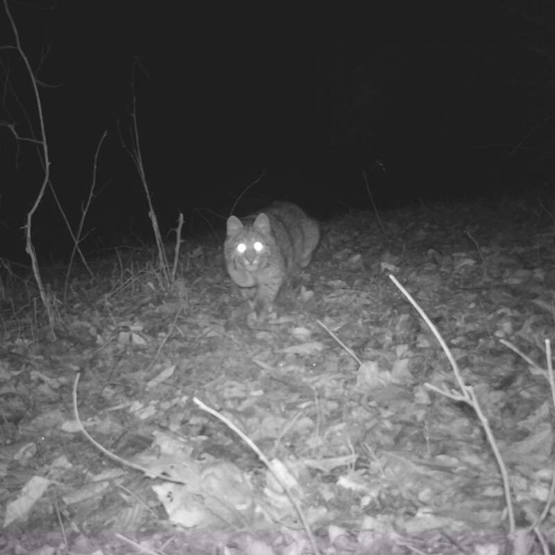
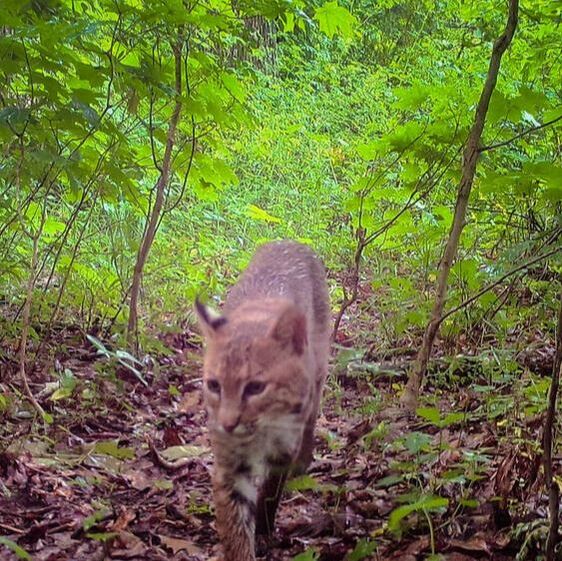
Celebrate the wildlife which calls Captina Creek watershed home by driving through both our aquatic trail and birding trail, or watch footage from our trail cameras in the comfort of your own home.
|

|
|
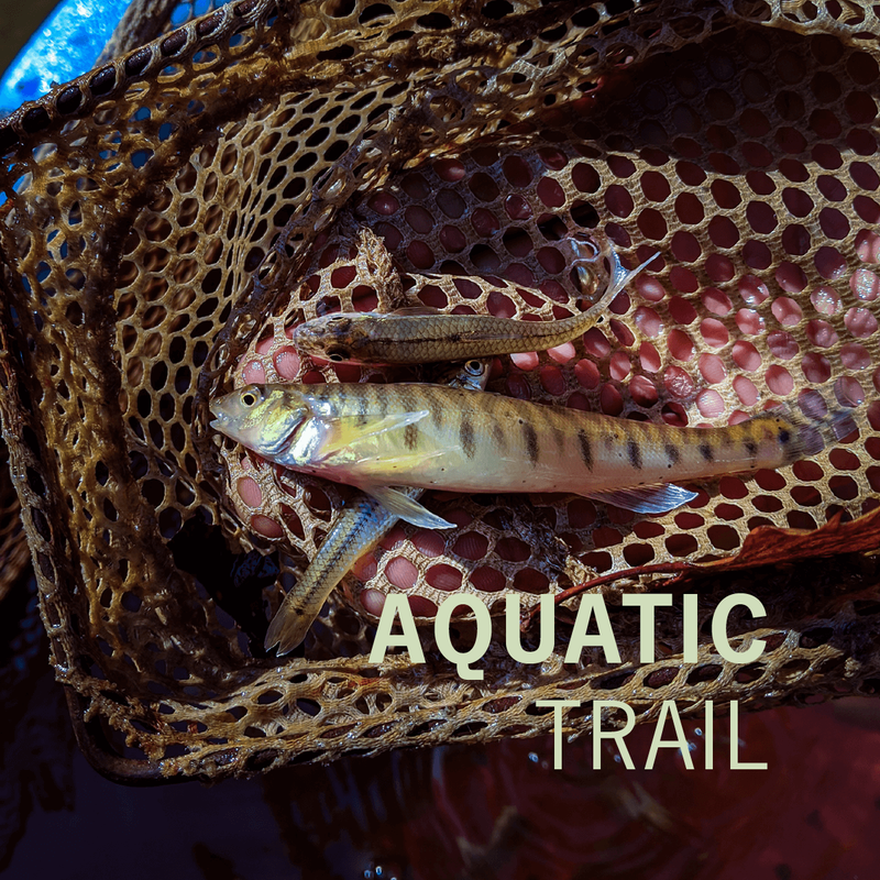
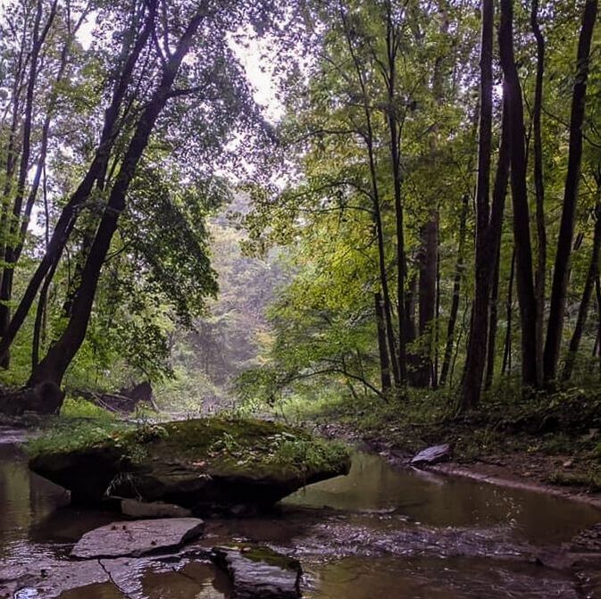
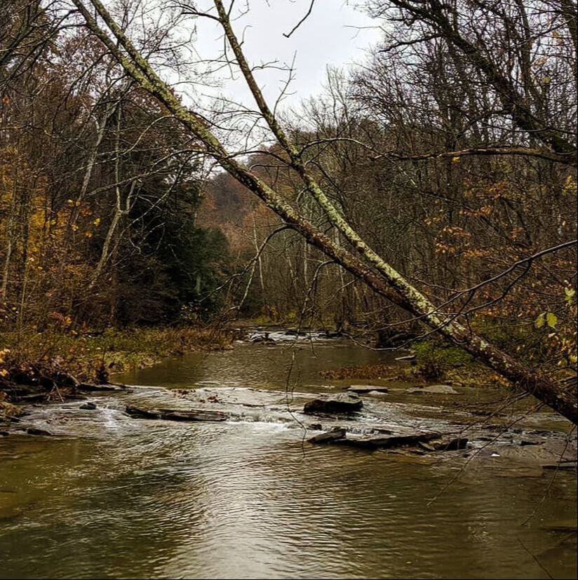
Captina Creek Aquatic Trail
A drive along State Route 148 from Powhatan Point to State Route 800 south of Barnesville will provide a nice showcase of the diversity in ecology and geology throughout the watershed.
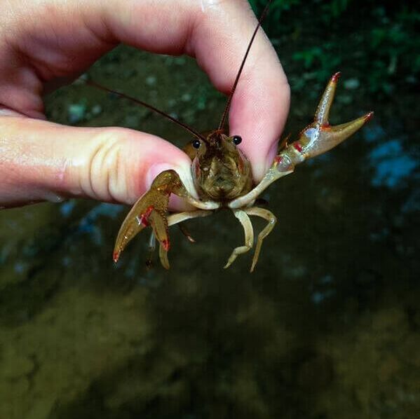
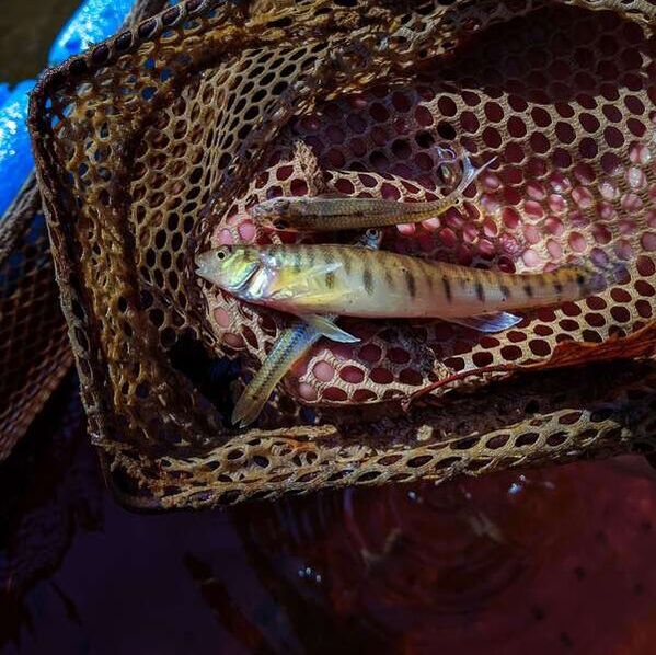
Captina Creek is home to one of the last breeding populations of the state-endangered Eastern Hellbender. The watershed also supports a healthy smallmouth bass fishery, along with 55 other species of fish. Of the 56 total fish species identified during a 2009 study by the Ohio Environmental Protection Agency, 17 are pollution intolerant. This same study found over 100 taxa of macroinvertebrates within the Captina Creek watershed making this one of the most ecologically diverse areas in the state of Ohio.
Captina Conservancy would like to thank Belmont County Tourism Council for funding this project.
|
|
|
Captina Creek Aquatic Trail Guide Locations
|
STOP #1 - MARINA, POWHATAN POINT
Directions: From Ohio State Route 7, turn onto Main Street in Powhatan Point and continue south on Main Street. Turn right to continue west onto Mellott Street. The Marina will be on your left. Geographical coordinates: 39°51’41.14”N, -80°48’16.39”W |
|
STOP #2 - CAPTINA CREEK MAINSTREAM. ALLEDONIA
Directions: From Powhatan Point, continue west on Ohio State Route 148 for approximately 12 miles. Turn left to continue south onto Belmont County Road 86 in Alledonia. The stop is located along Belmont County Road 86 just south of Captina Creek and the railroad. Geographical coordinates: 39°53’57.67”N, -80°58’8.96”W |
|
STOP #3 – RAVEN ROCKS
Directions: From Alledonia, continue west on State Route 148 for approximately 5 miles. Turn left to continue south onto Belmont County Road 92 for approximately 1.5 miles. Turn left onto Wayne Township Road 804 (Crum Road) and continue on this road for approximately 2 miles. The stop is located on your left at the Raven Rocks trailhead parking area. Geographical coordinates: 39°52’40.90”N, - 81° 2’18.21”W |
|
STOP #4 - RAINBOW’S END
Directions: From Raven Rocks, continue southwest on Wayne Township Road 804 (Crum Road) for approximately 1 mile. Turn left to continue north onto Wayne Township Road 41 (New Castle – Beallsville Road) for approximately 2.5 miles. Wayne Township Road 41 will turn into Ohio State Route 26 in New Castle. Continue north on Ohio State Route 26 for approximately 1.5 miles. Turn right onto School Land Road and continue east for a quarter mile. Park along this gravel road near the old barn. Continue on foot across the field to Captina Creek. The stop is located at the picnic area next to Captina Creek. Geographical coordinates: 39°54’13.79”N, - 81° 4’12.86”W |
Ohio Aquatic Life Resources
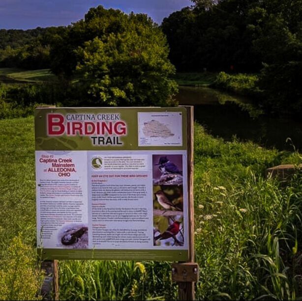
captina Creek Birding trail
The Captina Creek Birding Trail is a do-it-yourself driving tour with signage at five stops within the Captina Creek Watershed.
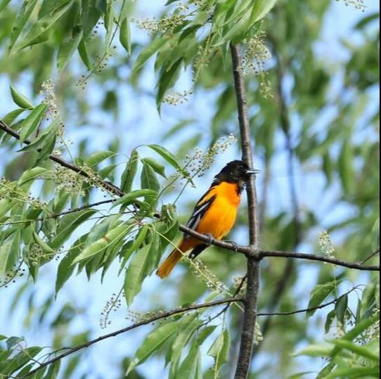
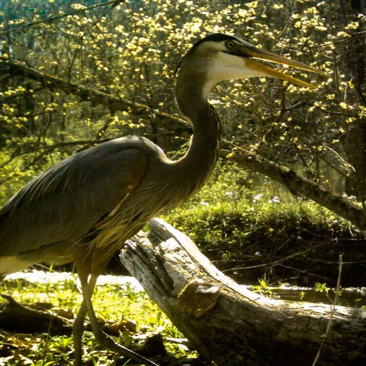
The American Birding Association describes birding trails as driving routes linking birding locations. According to Birding magazine, birding trails serve as “gateways to conservation and adventure” by combining ecotourism and regional education. Birding has been identified as one of America’s fastest-growing outdoor recreational activities, and this enthusiasm is evident in Ohio. Residents of the Ohio Valley area do not have to travel far for prime bird-watching opportunities. Belmont County is home to a variety of special bird species, such as tropical migrating birds like the Northern Parula, spotted at Raven Rocks; the Hooded Merganser, seen overwintering at the Powhatan Point Marina; and the Belted Kingfisher, found all along the Captina corridor.
The American Birding Association describes birding trails as driving routes linking birding locations. According to Birding magazine, birding trails serve as “gateways to conservation and adventure” by combining ecotourism and regional education. Birding has been identified as one of America’s fastest-growing outdoor recreational activities, and this enthusiasm is evident in Ohio. Residents of the Ohio Valley area do not have to travel far for prime bird-watching opportunities. Belmont County is home to a variety of special bird species, such as tropical migrating birds like the Northern Parula, spotted at Raven Rocks; the Hooded Merganser, seen overwintering at the Powhatan Point Marina; and the Belted Kingfisher, found all along the Captina corridor.
|
|

|
Captina Creek Birding Trail Locations
|
STOP #1 - MARINA, POWHATAN POINT
Directions: From Ohio State Route 7, turn onto Main Street in Powhatan Point and continue south on Main Street. Turn right to continue west onto Mellott Street. The Marina will be on your left. Geographical coordinates: 39°51’41.14”N, -80°48’16.39”W |
|
STOP #2 - CAPTINA CREEK MAINSTREAM, ALLEDONIA
Directions: From Powhatan Point, continue west on Ohio State Route 148 for approximately 12 miles. Turn left to continue south onto Belmont County Road 86 in Alledonia. The stop is located along Belmont County Road 86 just south of Captina Creek and the railroad. Geographical coordinates: 39°53’57.67”N, -80°58’8.96”W |
|
STOP #3 – RAVEN ROCKS
Directions: From Alledonia, continue west on State Route 148 for approximately 5 miles. Turn left to continue south onto Belmont County Road 92 for approximately 1.5 miles. Turn left onto Wayne Township Road 804 (Crum Road) and continue on this road for approximately 2 miles. The stop is located on your left at the Raven Rocks trailhead parking area. Geographical coordinates: 39°52’40.90”N, - 81° 2’18.21”W |
|
STOP #4 - RAINBOW’S END
Directions: From Raven Rocks, continue southwest on Wayne Township Road 804 (Crum Road) for approximately 1 mile. Turn left to continue north onto Wayne Township Road 41 (New Castle – Beallsville Road) for approximately 2.5 miles. Wayne Township Road 41 will turn into Ohio State Route 26 in New Castle. Continue north on Ohio State Route 26 for approximately 1.5 miles. Turn right onto School Land Road and continue east for a quarter mile. Park along this gravel road near the old barn. Continue on foot across the field to Captina Creek. The stop is located at the picnic area next to Captina Creek. Geographical coordinates: 39°54’13.79”N, - 81° 4’12.86”W |
|
STOP #5 – DYSART WOODS
Directions: From Rainbow’s End, continue north on Ohio State Route 26 for approximately 10 miles. In Bethesda, turn right to go east on Ohio State Route 147. Continue on Ohio State Route 147 through the town of Belmont and continue east past Belmont for an additional 5 miles. Turn right to continue south onto Smith Township Road 234 (Cool Hill Road) and take an immediate right onto Smith Township Road 194 (Dysart Wood Road). Continue on Dysart Wood Road for approximately a half mile. The stop will be located at the Dysart Woods parking area on the left. Geographical coordinates: 39°58’56.15”N, - 80°59’56.70”W |
Ohio Birding Resources
- Merlin Bird ID app (Cornell Lab of Ornithology)
- Common Birds of Ohio Field Guide (ODNR)
|
|
|